


la Brousse /Station du Mont Lozère

tyntyn
Gebruiker
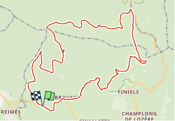

Lengte
30 km

Max. hoogte
1635 m

Positief hoogteverschil
604 m
Km-Effort
38 km

Min. hoogte
1200 m

Negatief hoogteverschil
603 m
Boucle
Ja
Datum van aanmaak :
2025-05-25 11:26:08.715
Laatste wijziging :
2025-05-25 14:18:03.686
2h51
Moeilijkheid : Medium

Gratisgps-wandelapplicatie
 SityTrail
IGN / Geografische instituten
SityTrail Plus
De wereld gaat voor u open
Over ons
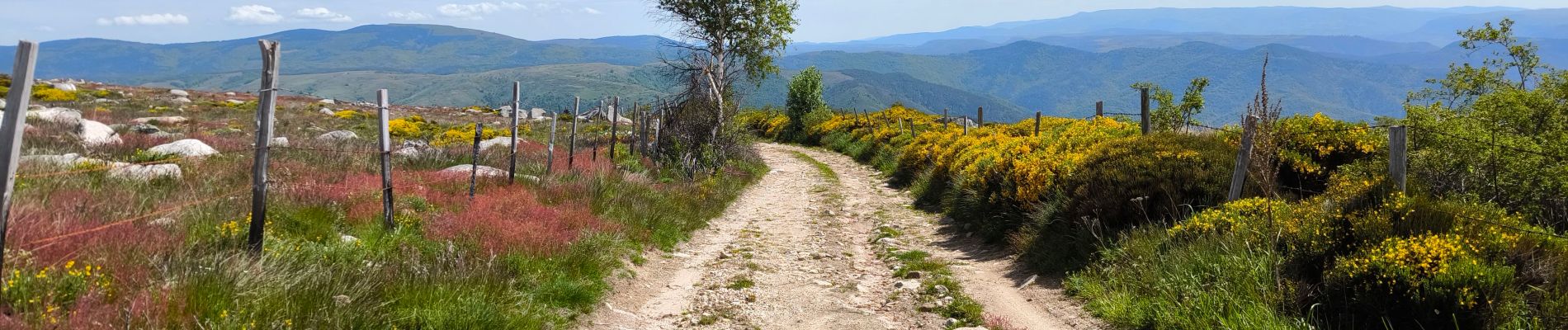
Tocht Mountainbike van 30 km beschikbaar op Occitanië, Lozère, Pont de Montvert - Sud Mont Lozère. Deze tocht wordt voorgesteld door tyntyn.
Foto's


Plaatsbepaling
Land:
France
Regio :
Occitanië
Departement/Provincie :
Lozère
Gemeente :
Pont de Montvert - Sud Mont Lozère
Locatie:
Fraissinet-de-Lozère
Vertrek:(Dec)
Vertrek:(UTM)
554609 ; 4916112 (31T) N.
Opmerkingen